New digital map technology supports better rail maintenance
New digital map technology supports better rail maintenance
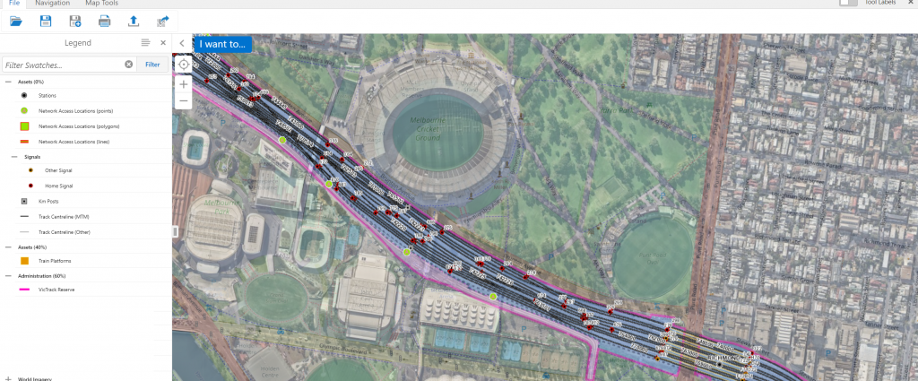
Innovative map technology is giving Metro Trains’ maintenance teams a complete digital picture of the Melbourne rail network to better plan and deliver works.
Known as MetroMap, the tool is designed to improve maintenance activities and network performance by providing a single portal for operations and maintenance staff.
Geographic Information System Lead Nevin Wilson said the new technology allows users to view station locations, track, signals, overhead structures, and other key rail equipment that is routinely maintained by Metro.
“MetroMap is a centralised system which collates multiple sources of information in a single application, so staff can see everything they need in the one place.
“It’s a user-friendly portal with information that is easy to understand.”
The application gives Metro staff access to a visual representation of 2D and 3D asset data, environmental information, and analytical tools to support infrastructure planning.
These capabilities will support improved maintenance and renewal across the network and ensure services continue to run safely and reliably for passengers.
Further enhancements to MetroMap are planned including integrating the system into other Metro systems and additional location search capabilities.
Production Manager – Infrastructure Patrick Raymond said MetroMap represents a major step change in the way maintenance work is currently planned and delivered.
“This really is a ‘one-stop shop’ to support the delivery of Metro’s maintenance and renewal program.
“By giving our people a full digital picture of the network, we can better plan our maintenance activities and ensure the network is performing to the highest possible standard.”
As part of its contract with the Victorian Government, Metro spends $12 million every week on works to maintain trains, rail equipment and technology.